Finding North When Your Phone Dies: Survival Skills for Every Hiker
Imagine you are deep in the woods, the sun is dipping low, and your phone just flashed a low-battery warning before going dark. That sudden knot in your stomach is...
Cole Mercer
Wilderness Guide & Navigation Specialist

Finding North When Your Phone Dies: Survival Skills for Every Hiker
Imagine you are deep in the woods, the sun is dipping low, and your phone just flashed a low-battery warning before going dark. That sudden knot in your stomach is real, but having the right survival skills can turn a potential panic into just another part of the adventure. Much like a cat always finding its way back to the porch, learning natural navigation techniques gives you a built-in sense of direction that keeps you safe when gadgets fail.
We are going to look at how to use a compass without getting frustrated and how to find your way by orienting without tools using just the sun and stars. It is about more than just not getting lost. It is about feeling as confident in the wild as a kitten in a sunny spot. You will learn the shadow tip trick for daytime travel and how to use the North Star as your cosmic GPS at night.
From reading the ridges of the land to debunking myths about moss, this guide covers the wilderness pathfinding basics every hiker needs. You will walk away ready to step off the beaten path with total confidence and a new way of looking at the world around you.
Finding Your Way Home When the GPS Fails
Picture this: you are miles from the nearest road when your phone suddenly dies. That sinking feeling hits hard. But what if you did not need a screen to find your way back? Learning to read the land is like having a secret superpower. It keeps you calm when technology fails and helps you feel more at home in the wild.
Natural pathfinding is about more than just survival. During the day, the sun acts as your guide, and at night, the stars take over. Even a simple compass is a game-changer. You just hold it steady and line up the magnetic needle with the north arrow. It is a basic tool that never runs out of battery or loses signal.
A paper map also tells a story. It uses contour lines to show you where the ground rises and falls, helping you spot ridges or water before you even see them. These skills turn a scary situation into a manageable one. Instead of panicking, you are simply using your head to find the way home.
Key insights:
- Physical maps and compasses provide a necessary backup for unreliable electronics.
- Learning to read terrain features like ridges and water sources builds confidence.
- Using the sun and stars for direction fosters a deeper connection to nature.
The Trusty Compass: It Is Easier Than It Looks
Ever feel like your phone is a ticking clock in the woods? When the battery hits zero, a basic compass becomes your best friend. It is a simple piece of plastic, but it does not need a signal or a charger. Most people get intimidated by the dials and numbers, but it is easier than it looks. It mostly comes down to one trick: Red in the Shed. This just means keeping the red magnetic needle inside the red orientation arrow on the base. If you can do that, you stay on track. The biggest mistake is holding it near your phone or a metal belt buckle. Metal messes with the magnet, making your compass lie to you.
To get a real reading, you have to hold the compass flat and steady in the palm of your hand. Point the direction of travel arrow where you want to go, then rotate the dial until the magnetic needle aligns with the north arrow. Now you have established your orientation. This simple process is a safety responsibility that cuts through the panic of being lost. It gives you a backup system for when technology fails, which happens more often than we like to admit. It is about taking charge of your own safety instead of hoping for a signal.
Then there is the map. Those squiggly contour lines look like a mess at first, but they are actually a picture of the ground. When the lines are tight together, you are looking at a steep cliff. When they are far apart, it is a flat meadow. To make it work, you have to match the paper to the mountains in front of you. Align the map north with your compass needle. Suddenly, the landscape makes sense. You can find water sources or avoid dangerous ridges just by reading the symbols. Using the map scale also helps you estimate how long it will take to get back to the car.
Think of it this way: a compass and a map are the core of your survival gear, alongside your first aid kit and a good flashlight. While the sun can serve as a natural guide during the day, these tools give you precision. Learning to trust them builds a deeper connection to the wild. You stop being a visitor who is glued to a screen and start being someone who truly understands the environment. It turns a stressful hike into a confident adventure because you always know exactly where you stand.
Key insights:
- A compass provides a reliable backup that works without batteries or cell service.
- The Red in the Shed method is the simplest way to maintain your heading.
- Map contour lines reveal the shape of the terrain, helping you avoid cliffs and find water.
- Metal objects like phones or belt buckles can interfere with compass accuracy.
Making the Needle Work for You
Ever feel turned around in the woods? Having a compass is great, but making that needle work for you is what gets you home. Start by holding the compass flat and steady in your palm at waist height. Keep the direction of travel arrow pointing straight away from your body. If you tilt it, the needle might stick and give a wrong reading.
Now for the physics. Watch the magnetic needle swing. Rotate the clear housing until the orienting arrow inside the circle lines up with the needle. Think of it like a cat catching a laser pointer. Once they are stacked, you have found north. This simple act turns a tool into a lifesaver and stops the panic felt when a phone dies.
With the needle aligned, look where your travel arrow points. That is your path. It is also smart to align your map north markings with your compass to make the paper match the ground. While the sun helps during the day, a compass is best for finding a specific ridge or water source.
Key insights:
- Keeping the compass level is the most important step for an accurate reading.
- Aligning your map with your compass helps you visualize the terrain more clearly.
- Learning manual tools reduces stress when technology fails in the wild.
Reading the Map Like a Pro
Ever look at a paper map and wonder why it is covered in brown, squiggly circles? Those are contour lines. They are not just random patterns. They tell you exactly how tall a hill is or how steep a trail gets. When the lines are packed tight together, you are looking at a cliff or a very sharp climb. If they are spread out, the ground is mostly flat. Learning to read these shapes helps you pick a path that won't leave you gasping for air or stuck at a dead end.
To make sense of it all, you have to match the paper to the peaks in front of you. This is map orientation. You align the north arrow on your map with your compass needle. Suddenly, that big ridge to your left shows up as a long series of loops on the page. It is a bit like a 3D puzzle. You can also spot blue lines for water sources or specific symbols that warn you about rocky drops. This turns the landscape into a clear set of instructions.
Why bother with paper when you have a phone? Because batteries die and signals drop. Knowing how to spot a creek or a safe ridge using just your eyes and a map is a huge safety net. It turns a stressful situation into a manageable one. Plus, it just feels good to know you can find your way home without needing a satellite. It builds a real connection to the woods that a screen simply cannot provide.
Key insights:
- Contour lines reveal the steepness of the terrain before you even take a step.
- Physical maps provide a reliable backup for when technology fails in the wilderness.
- Matching map symbols to real landmarks builds confidence and reduces panic.
Nature’s Built-in GPS: Finding North During the Day
Imagine your phone dies and you are suddenly surrounded by silent trees. It is easy to feel a flash of panic, but you have a massive guide right above you. The sun is essentially a giant, glowing compass that follows a predictable path across the sky every single day. While it does not always rise exactly in the east or set exactly in the west depending on the season, its general movement gives you a solid baseline for where you are. Tracking this path is more than just a cool trick; it is a safety responsibility that keeps you from making wrong turns when you are tired or disoriented.
If you happen to be wearing an analog watch, you have a backup navigation tool right on your wrist. To find south in the northern hemisphere, point the hour hand directly at the sun. The point halfway between that hour hand and the 12 o'clock mark is your north-south line. It is a quick, clever trick that turns a simple piece of jewelry into a survival tool. This kind of self-reliance is a big part of staying safe and feeling connected to the world around you when you are off the grid. It builds a redundancy system so you are not stuck if your GPS fails or the batteries die.
But what if you do not have a watch? That is where the stick and shadow trick comes in. This is one of the most reliable ways to get your bearings using nothing but what you find on the ground. First, find a straight stick about three feet long and push it into a flat, clear patch of dirt where it can cast a distinct shadow. Mark the very end of that shadow with a small stone or a scratch in the dirt. This is your first data point. You will need to be patient here, because you are waiting for the earth to rotate enough for the shadow to move.
After about fifteen to twenty minutes, the shadow will have shifted noticeably. Mark the new position of the shadow's tip exactly like you did the first one. Now, draw a straight line between your two marks to create an east-west line on the ground. Because the sun moves toward the west, your first mark is always the west point and the second is the east point. If you stand with your left foot on the first mark and your right foot on the second, you will be facing north. It is a simple way to create a physical compass right at your feet.
The interesting part about these methods is how they change your perspective on the hike. Instead of just staring at a glowing screen, you are actually interacting with the movement of the planet. It is a primitive skill, but it is incredibly effective for reducing uncertainty and panic in the wild. Even if you have a topographical map in your bag, knowing how to use natural cues like the sun provides a vital backup for when modern technology fails you. It makes the journey feel more like an adventure and less like a commute.
Key insights:
- Natural navigation techniques provide a reliable redundancy system for when modern technology or batteries fail.
- The shadow-tip method requires patience but offers a highly accurate way to establish an east-west baseline without tools.
- Attuning to environmental cues like the sun's path fosters a deeper connection to the natural world and reduces wilderness anxiety.
The Stick and Shadow Trick
Imagine your phone screen stays black just when you need it most. It is a sinking feeling, but you do not need a battery to find your way. Since the sun moves in a predictable arc, it acts as a reliable natural compass during the day. All you need is a straight stick and a bit of flat dirt. This works because the earth's rotation creates a shifting shadow that reveals direction.
Find a clear patch of ground and push a three-foot stick into the earth. Mark the very tip of its shadow with a small stone or a scratch in the dirt. Now comes the hard part: waiting. You need at least fifteen minutes for the sun to move enough to change the shadow's position. This patience is your best tool for accuracy. Once the shadow moves, mark the new tip.
Draw a line between your two marks. This creates a clear east-west line on the ground. The first mark is always west and the second is east. Stand with the first mark on your left and the second on your right, and you are facing north. It is a simple backup for when technology fails, helping you stay calm and focused.
Key insights:
- The first shadow mark always represents west, while the second represents east.
- Waiting at least fifteen minutes ensures the sun moves enough for an accurate reading.
- Natural navigation provides a vital redundancy system when GPS or batteries fail in the wild.
Looking Up: How the Night Sky Guides You
When the sun goes down and your phone battery hits zero, the woods can feel a lot more intimidating. But the sky is basically a glowing map that never runs out of power. Many hikers are returning to these old-school skills as a backup for when tech fails. You can even get a general sense of direction from the moon. Since it rises in the east and sets in the west, it acts as a natural guide. If you see a crescent, the points usually aim away from the sun, which helps you orient yourself during the night.
Think of the Big Dipper as your main cosmic signpost. It is easy to spot and serves as the starting point for finding your way. Using natural cues like this does more than just keep you safe. It helps you feel connected to the wild. When you stop staring at a screen, you start noticing how the stars and the landscape work together. This awareness turns a hike into a much richer experience and keeps your mind sharp.
To find the North Star, look at the two stars on the outer edge of the Big Dipper bowl. These are known as the pointer stars. If you follow an imaginary line from them, you will hit Polaris. This star is special because it is the only one that stays put while the others seem to move across the sky. Because it sits almost directly above the North Pole, it is a reliable anchor for anyone who is lost. It is a simple trick that provides a constant in an ever-changing environment.
You can even estimate your latitude by looking at how high the North Star is in the sky. If the star is halfway up, you are roughly at 45 degrees north. Learning these skills is a big part of your safety responsibility. It reduces panic because you always have a way to find north. Even with a compass and map in your pack, these skills are your reliable backup system. They ensure that even if everything else fails, you can still find your way home.
Key insights:
- The North Star is the only star in the northern sky that does not change position.
- Natural navigation provides a vital redundancy system for when electronic devices fail.
- The moon can be used as a rough compass because of its predictable east-to-west path.
- The height of Polaris in the sky directly relates to your latitude on Earth.
Finding the North Star
Think about the last time you looked at the stars without a phone screen in your way. When your GPS fails, the night sky becomes your most reliable backup plan. To find the North Star, or Polaris, you first need to spot the Big Dipper. Look at the two stars forming the outer edge of the dipper's bowl. These are your pointer stars. If you follow an imaginary line from them across the sky, they lead your eyes straight to Polaris.
Here is the thing: while every other star seems to move as the night passes, the North Star stays put. It sits almost exactly above the North Pole, acting as a fixed anchor in a rotating sky. This reliability helps reduce the panic of being lost because it gives you a constant point of reference. Sometimes, a simple natural cue is more comforting than a flickering digital screen.
You can even estimate your latitude by looking at how high the star sits. Its angle above the horizon roughly matches your position on Earth. If it is halfway between the horizon and the point directly above you, you are at about 45 degrees north. This trick turns the sky into a map, proving that natural navigation provides a vital redundancy system for when modern technology fails.
Key insights:
- The North Star is the only celestial body that remains in a fixed position throughout the night.
- Using the 'pointer stars' in the Big Dipper is the easiest way to locate Polaris.
- The height of the North Star above the horizon can be used to estimate your current latitude.
Reading the Ground Under Your Feet
Have you ever been told that moss only grows on the north side of trees? It sounds like a handy shortcut, but relying on it is a quick way to get turned around. In reality, moss just likes shade and moisture. In a thick, dark forest, that could be literally anywhere. Instead of looking for small green patches on bark, you need to look at the big picture. The land itself tells a much more reliable story if you know how to read the shapes under your boots.
Think of ridges and rivers as your handrails in the wild. If you know a river runs north to south, and you stay on its east bank, you have a constant reference point that will not disappear. This is terrain association. It is all about matching what you see on a topographical map, like those squiggly contour lines showing elevation changes, to the physical world around you. When you align your map with the landscape, the world starts to make sense. It stops being a wall of trees and starts being a clear path.
Nature leaves other clues if you know where to look. Trees in windy areas often lean in the direction the wind blows most often. During the day, the sun serves as a natural compass to help you stay oriented. In the northern hemisphere, south-facing slopes get more sun, so the plants there might look different or grow thicker than those on the shadowed north side. These natural cues provide a vital redundancy system. While a compass is a fundamental tool for any hiker, knowing these tricks means you are not helpless if your technology fails.
Learning these skills is a real safety responsibility. it reduces that sudden spike of panic when you realize the trail has vanished. By staying aware of your environment, you are not just avoiding getting lost. You are building a deep connection to the natural world. What does this mean for your next trip? It means you can look at the ground and finally understand the map written in the dirt and trees.
Key insights:
- Terrain features like ridges and rivers act as permanent physical handrails for pathfinding.
- Moss growth is determined by moisture and shade rather than a fixed compass direction.
- Environmental cues like wind patterns and sun position offer a reliable backup when tools fail.
- Reading the landscape builds confidence and reduces the risk of panic in the wilderness.
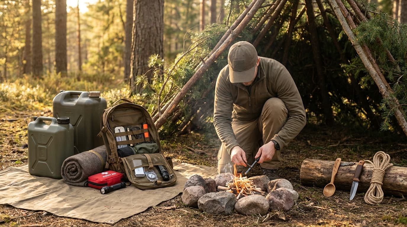
The Gear That Keeps You Moving
Think of your pack as a life-support system for the trail. When your phone screen stays black and you are miles from the trailhead, you need the 'Big Five' navigation essentials to get home safely. This kit includes your topographical map, a reliable compass, a first aid kit, proper clothing, and a flashlight. These items are the gold standard because they do not rely on a cell tower or a charging cable. A map gives you the layout of the land, showing you water sources and steep ridges through those squiggly contour lines. It is the physical blueprint of the woods that stays true even when your battery hits zero.
Using these tools is simpler than it looks, but it takes a little focus. When you hold your compass, keep it steady and point the travel arrow away from you. You just rotate the housing until that magnetic needle lines up with the north arrow. That is it. Now your map and the ground under your boots finally match up. It is a huge relief when you realize you can actually see the ridge or water body the map promised was there. This kind of skill turns a moment of panic into a manageable plan. It is about taking responsibility for your own journey.
Now, consider the low-tech heroes of your kit: a notebook and a pencil. People often overlook these, but they are vital for tracking your progress or sketching landmarks you pass. If the clouds roll in and the weather turns sour, you have to keep your map dry. A simple plastic sleeve or even a clear baggie works wonders to keep your paper from turning into mush. Also, remember that the sun is your natural compass during the day. If you lose your gear, looking at the landscape or the sky gives you a backup plan. It is about being self-reliant so you can actually enjoy the woods instead of just worrying about the way back.
Key insights:
- Physical maps provide a vital redundancy system when modern technology fails or loses power.
- A notebook and pencil allow you to record landmarks and travel times for more accurate pathfinding.
- Protecting paper maps from moisture is a critical but often forgotten part of wilderness preparation.
Staying Calm: The Most Important Skill
You are deep in the woods when it hits you: the trail is gone. Your heart starts racing and your first instinct is to run. But here is what is true. Panic is a bigger threat to your safety than being lost is. When you lose your cool, you stop thinking clearly. You might ignore the topographical map in your bag or forget that the sun can act as a natural compass during the day. Staying calm is not about being brave. It is a specific skill that keeps you alive.
To keep your head, use the S.T.O.P. rule. First, Sit down. This act breaks the cycle of panic. Next, Think about how you got here. Observe your surroundings for water sources or terrain changes like ridges. Finally, make a Plan. This process turns a scary situation into a series of small tasks. Think of it like a cat in a new room. They do not just bolt; they sit and observe. Many hikers are moving back toward these primitive skills because they build real self-reliance.
Think of your gear as a safety net for your mind. When you know how to align a compass needle with the north arrow or read contour lines on a map, you feel in control. That confidence is what keeps you moving forward instead of spinning in circles. Even if you do not have a compass, knowing you can find north by watching the sun or stars makes a difference. This awareness does more than just keep you safe. It makes your time in the wild feel personal.
Key insights:
- Panic is often more dangerous than the actual situation of being lost.
- The S.T.O.P. rule provides a mental framework to regain control.
- Knowledge of natural cues acts as a redundant safety system when technology fails.
Conclusion: Walk Boldly into the Wild
Think about the last time you felt truly at ease in the woods. That feeling comes from knowing you can handle whatever happens. Redundancy is your best friend out there. Carrying a physical map and compass creates a vital backup for when your phone battery hits zero. But don't wait until you're lost on a ridge to figure it out.
Try these skills in your backyard first. Practice aligning that magnetic needle with the north arrow while you're still close to home. You can even use the sun as a natural compass during the day. It helps. When you stop relying on a screen, you start noticing landscape features and water sources more clearly.
This awareness turns a simple hike into a deep experience. Learning to read the land is a responsibility that cuts out the panic of getting lost. It makes the journey feel personal. Walk boldly. You finally know exactly where you are going.
Key insights:
- Natural navigation acts as a reliable backup when electronics fail.
- Environmental awareness fosters a deeper connection to the outdoors.
- Practicing skills in safe environments builds confidence for the wilderness.
Frequently Asked Questions
Conclusion
So what does all this mean for your next trip? It means that survival skills are about more than just backup plans. When you know how to read the sun, follow the stars, or trust a simple compass, you aren't just avoiding getting lost. You are learning to see the woods in a whole new way. You start noticing the angle of light and the shape of the hills instead of just staring at a screen.
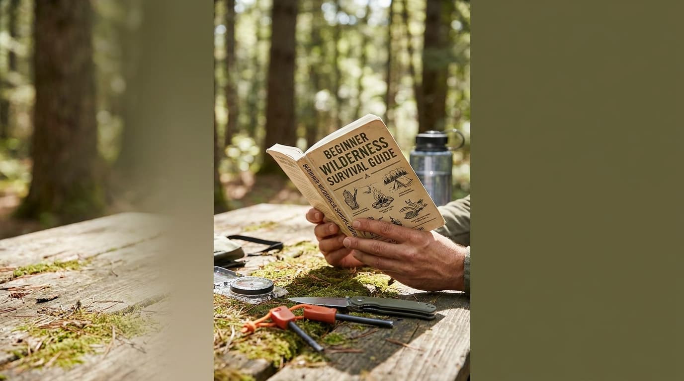
The best way to get good at this is to try it out when you don't actually need it. Take a map and compass to your local park or even your own backyard. Get a feel for how the shadow-tip method works on a sunny afternoon. You will find that these natural navigation techniques become second nature faster than you might think.
Technology is great until the battery hits zero, but your own awareness never runs out of power. Walk boldly, keep your eyes open, and enjoy the peace of mind that comes with knowing exactly where you are.
Send it to someone who should read it next.
About the author

Cole Mercer
Wilderness Guide & Navigation Specialist
Covers map reading, route planning, land navigation, and lost-person response with a focus on staying calm and moving smart outdoors.
View all articles